


The Valley of the Semois / Semoy
À Tournavaux
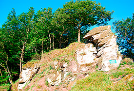
A - The ‘Roche aux Corpias’ Voir sur la carte
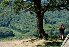
The panoramic view from the ‘Roche aux Corpias’ or raven’s rock reveals the lovely Semoy river winding its way charmingly back and forth. But gentle as it may look, the river can be merciless. The people of Tournavaux still remember when, at the end of the 19th century, these usually beautiful waters rose higher than the first floor of the houses…
À Nohan
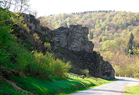
B - Linchamps Castle Voir sur la carte
It is said that the ghost of the last chatelaine still haunts this place, resting in a crevice in the ruins of an old tower called the spinner’s chair. Some evenings, you can still hear her spinning wheel turning.Learn more
Walking Voir sur la carte
When ridge becomes rampart
The remains of the fortified castle can be reached from Naux. This walk reveals the arabesques shaped by the Semoy, between sheer cliffs and vast beech forests. The ridge above the valley is truly superb. Allow three hours for 8.5 kilometres.
Practical details
Distance: 8.5 km
Waymarking: white/red
Difficulty: average
Time: 3 h
Start: from Naux, cross the footbridge and follow the old railway bed along the river.
To go further afield… Voir sur la carte
Topo guide, Les Ardennes à pied (The Ardennes on foot), published by the Fédération Française de la Randonnée Pédestre (French Hiking Federation). Walk No 8.
Did you know? Voir sur la carte
1530: this was a cruel, murky period of history. Francis I was constantly in conflict with Charles V. Banished from his land, Jean de Louvain took advantage of their rivalry and built this fortress on the fringes of the kingdom. He hired mercenaries to carry out raids on the Holy Roman Empire. Much later on, he spread terror throughout the heart of the Semoy valley, demanding tolls from boats carrying wood. The gloomy fortress was destroyed on the orders of Louis XIV and all that remain are a few steps hewn out of the rock.
À Les Hautes rivières
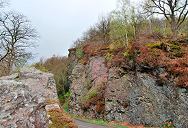
C - The ‘Roche du Saut Thibault’ Voir sur la carte
Legend has it that a certain Lord Thibault, fleeing on horseback and pursued by his enemies, spurred on his mount so vigorously that it crossed the river in a single bound, leaving the imprint of its horseshoes in the rock.
Tip Voir sur la carte
A narrow path leads to the summit of the rock, opening out onto a superb view over the valley of St Jean.
Access: from Les Hautes-Rivières, take the narrow route at the bottom of the valley (for about two kilometres) towards the little village of Linchamps.
À Les Hautes rivières
D - The Roche Margaut Voir sur la carte
Just a few strides will take you to the beauty spot overlooking the commune of Les Hautes-Rivières.
Access: from the centre of the village, follow the signs.
À Bohan
E - Walking Voir sur la carte
The Fairies’ Table walk
The rocky spurs standing sentinel above the Semois are brimming with legends. Folklore and local history are inextricably entwined in Bohan.
The Fairies’ Table (Table des Fées) walk takes in four legendary sites.
In the forest, at the point when the path narrows, the Châtelet or little castle appears, a pile of rocks said to have been used as a refuge by the Celts, the people who lived in the region at the time. Legend has it that enchantresses danced in the moonlight on the Fairies’ Table on the eastern slope. A tale of fantasy inherited from this forgotten people. Further on, to the north, when the ridge becomes a spine, the path crosses a huge stone known as the ‘Fairies’ Hearth’ (Cheminée des Fées). Back in Bohan, the Marriage Stone (Pierre à Marier) welcomed couples wishing to commemorate their marriage.
Practical details
Distance: 5 km
Waymarking: yellow rectangle
Difficulty: average
Time: 1.30 h
Start: the walk starts from Bohan church
À Bohan
F - The Valley of the Huts Voir sur la carte
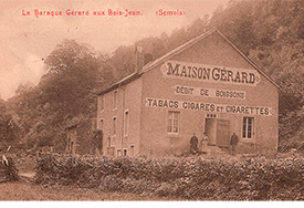
From Bohan, our steps mingle with those of the French smugglers who took these secret paths to reach huts in the heart of the wood, trading places on Belgian territory where tobacco, coffee and other goods were sold far more cheaply… and where they could eat a fricassee and drink beer.
Walking Voir sur la carte
The Valley of the Huts (Vallée des Baraques) formed by the Bois Jean stream is also the scene of a lovely hike. Starting from Bohan and the superb ‘Roche la Dame’ beauty spot, it follows secret paths to these old trading places.
Practical details
Distance: 14 km
Waymarking: red rectangle (No 37)
Difficulty: difficult
Time: 3.30 h
Start: the walk starts at the church in Bohan, climbing straight up from the route de Sugny.
Did you know? Voir sur la carte
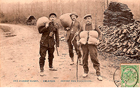
The smugglers carried tobacco and bread, foodstuffs that were less heavily taxed and cheaper, from Belgium into France. This gave rise to manhunts. The customs officers, known as ‘les gabelous’, patrolled the forest, spending the night there to try and flush out these ‘fraudeurs’ who often had more than one trick up their sleeve…
À Membre
G - The Jambon beauty spot Voir sur la carte
Between Membre and Bohan lies the well-known Jambon beauty sCOGpot which, along with that of the Giant’s Tomb, in Botassart, is one of the most famous in the Ardennes. The Semois traces a two-kilometre loop here. The name, referring to its shape, recalls an Ardennes cold meats speciality. Its slopes and hills make up most of the Membre-Bohan National Park. This nature reserve, which covers 177 hectares, is of interest mainly for its outstanding panoramas. It is home to a number of natural curiosities with highly evocative names, such as the ravin du Sautou, the Châtelet, the Cheminée, the Trou de l’Homme sauvage, the Roche la Dame, and the Table des Fées.


