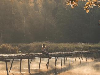
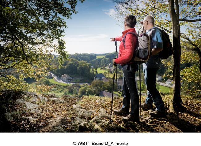
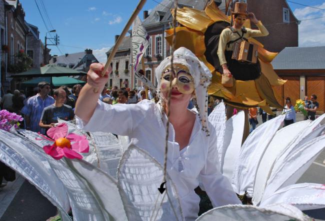
The best walks around beautiful villages with a restaurant

20 walks around a village with at least a restaurant, café or brasserie for you to print
The Ardenne without an "s" is the sum of the Ardennes with an "s": the Belgian Ardennes, French Ardennes or Luxembourgeois Ardennes, known as the Éislek. The Ardenne in the widest sense is also a variety of soils, lands and landscapes. There is the geological Ardennes massif, but also the Fagnes-Famenne on the Calestienne, the Lorraine gaumaise, the Pays de Herve and the Condroz. All still are home to such differently coloured villages. Together with our friends at the Association of the Most Beautiful Villages in Wallonia, Visit Éislek and the Ardennes Tourist Development Association, we have made a selection of 20 walks of about an hour each to enjoy with family members or friends or as a couple, with the bonus of a restaurent, café or brasserie serving regional specialities at the end for a meal or a drink.
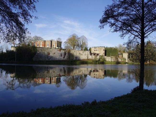
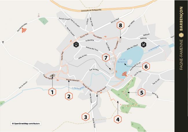
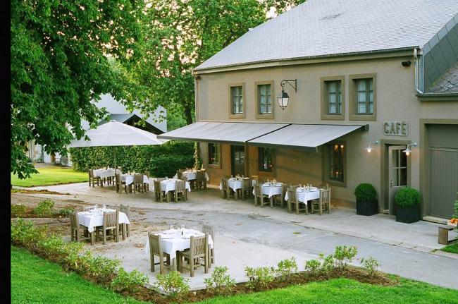
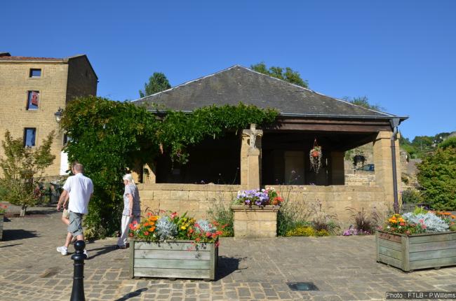
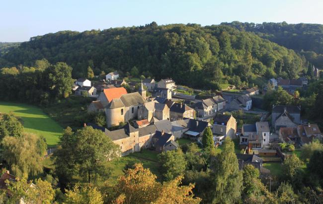
This relatively little-known village is located on the Calestienne in the Fagne-Famenne agro-geographical region, a few kilometres from Beaumont and Boussu-lez-Walcourt. It is charming and well worth a special trip! The Lords of Barbençon had their seat here and have left traces behind. This walk explores St Lambert's church, the Rue des Marbriers, St Joseph's chapel, the Station d'Ifs nature reserve, the chapel of Our Lady of Lights, the very photogenic lake at the foot of the ramparts, the castle and also farmhouses with sweet names like "La Perruque", "Jette Feuille" and "La Bouverie".
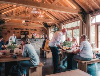
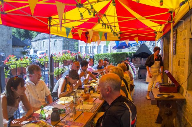
Speaking of sweet names, they certainly apply to the restaurant or the café-brasserie where you can stop, if only for a Chimay Trappist beer. On the village side is "Starchef Auberge du Lac", while on the lake side is "Lac de Barbençon, la Brousse".
Location: Beaumont, Province of Hainaut, Fagne-Famenne region, Belgium
More info : www.beauxvillages.be
Download the walk
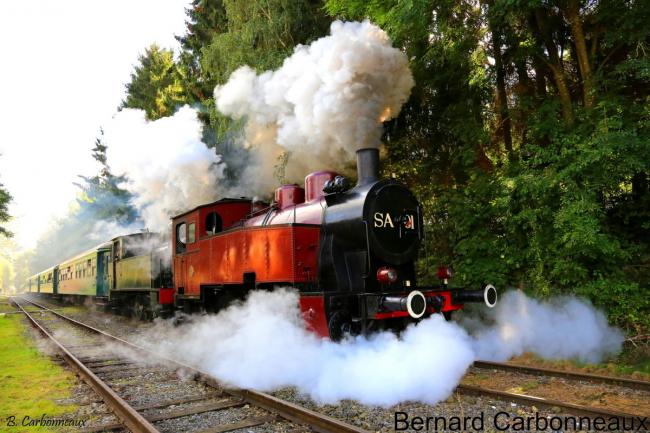
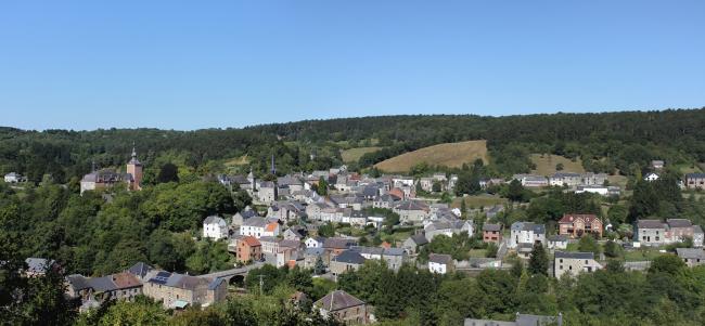
You'd think you were in the South! With your belongings in your backpack, get on the steam train at Mariembourg to visit this village proudly overlooked by its feudal castle and surrounded by scrubland on the limestone meadows. Vierves-sur Viroin is served by the (really) exceptional Three Valleys Steam Railway. From the station, set off to explore the village, following your nose along the narrow streets and making sure you see the castle, the church, the viewpoint and the nature centre. Have lunch or a drink there and then walk along the Promenade du Fond de Chaule to visit Treignes, with its five museums.
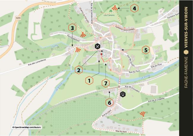
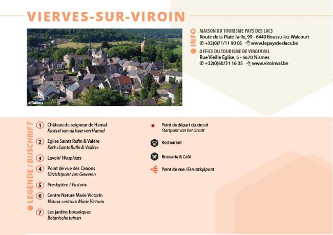
The best approach is to stay overnight in Treignes. You will then have time to visit the Arthur Masson Centre (the Ardennes equivalent of Marcel Pagnol) with its old-fashioned school; the Viroin eco-museum; the steam railway museum, the Malgré-Tout museum and the miniature format museum!
Location: Viroinval, Province of Namur, Fagne-Famenne region, Belgium
More info: www.beauxvillages.be
Download the walk

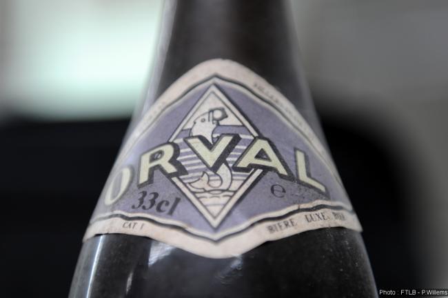
One of the most beautiful flower-filled villages in the French Ardennes, Williers has certainly been blessed by the gods. Perched on a rocky outcrop divided by a wall probably first built in the Celtic or Roman era, its street-like, narrow, shady square reminds us of the alleys of plane trees in the South-West of France. The Fond de Nanty stream flowing through the village serves as a national border. It flows towards the famous Our Lady of Orval Cistercian abbey in Belgium, where you can enjoy a pretty walk through the Orval Meadows nature reserve. Just push open the abbey door to enter one of the most remarkable places in Belgium.
Don't hesitate to book a stay in Williers, but make sure to remember this. From Williers, walk for a few minutes down to Chameleux in Belgium. When you arrive there, on the ancient Roman road from Rheims to Trier, built in 45BCE under the Emperor Claudius, stop for a meal or a drink at the Bistrot de terroir "Le Chameleux", just as travellers and soldiers did 2,000 tears ago at the inn whose beautiful remains are nearby. The biggest difference today is that the Orval beer you're enjoying will have just been brought up from the cellar once it's reached its best age!
Location: Williers, Ardennes département, Lorraine region, France (below Florenville, Belgium)
More info: www.ardennes.com
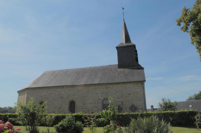
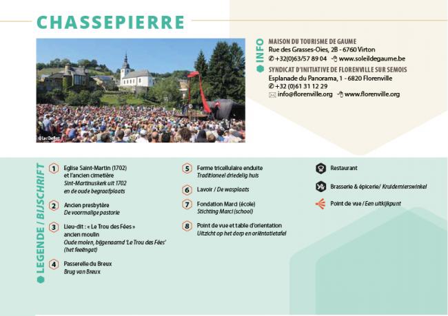
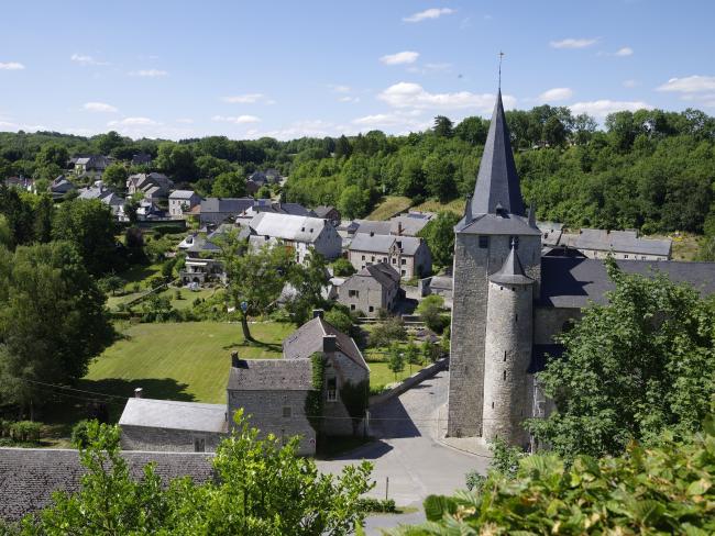
Famous for its Street Arts Festival held every August, the longest-running event of its kind in Europe, this village in the Lorraine gaumaise region is near Williers, and is watered by the pretty River Semois. Its lovely situation has inspired many painters. It offers a restaurant, a brasserie, three viewpoints from above and below and an eight-stage walk : St Martin's church dating from 1702 with its ancient graveyard, the priest's house, the former Fairy's Hole mill (there are lots of former watermills in the valley if you know what to look for), a footbridge over the river, a three-winged farmhouse, a public wash house, a former school that now houses the Marci Foundation and an orientation table overlooking the first foothills of the Ardennes.
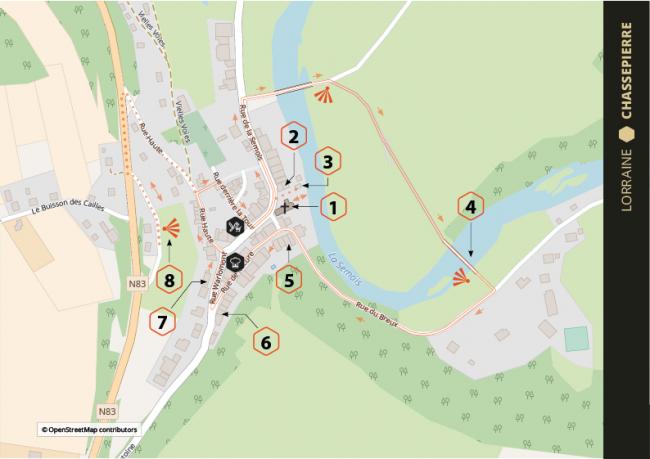
Make sure you don't miss the farmers' market held on Sunday mornings.
Location: Florenville, Province of Belgian Luxembourg, Belgium.
More info: www.beauxvillages.be
Download the walk
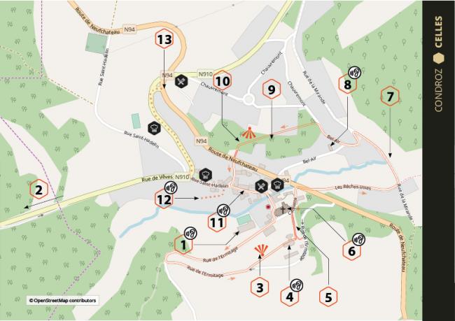
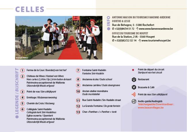
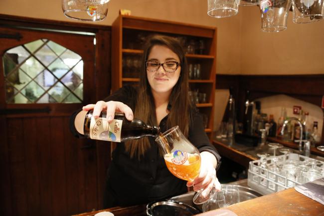
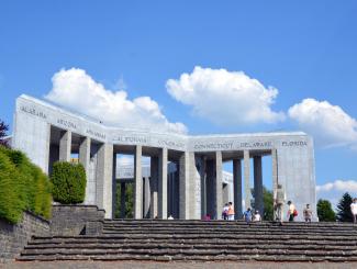
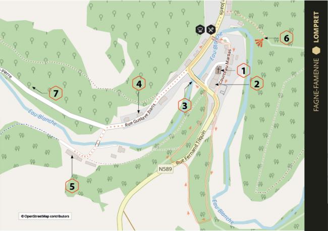
In general, the Condroz region around Namur is worth a special trip. Celles is one of its limestone-grey gems. The walk should be called a foodie one, given the eating places available. Start at the viewpoint at the the De la Cour farmhouse. Then follow the Chemin de Croix to explore St Hadelin's Collegiate Church, a Walloon Exceptional Heritage Site, then fountains, a former quarry, an old school, the Rue Saint-Hadelin and its famous Panther tank, marking the spot where the advance of General von Rundstedt's army was halted on 24 December 1944 during the Battle of the Bulge.
Finally, don't miss the nearby Vêves Castle where kids can put on a costume for a guided tour of this castle that looks like the one in the Sleeping Beauty fairytale.
Location: Houyet, Condroz namurois district, Province of Namur, Belgium.
More info: www.beauxvillages.be
Download the walk
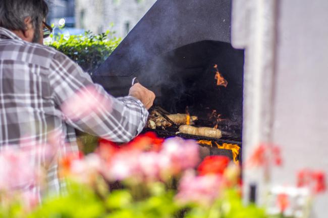
A stone's throw from the seat of the Princes of Chimay (a guided tour of the castle and the terraced square will impress you), this Calestienne limestone village nestles in a small greenery-covered bend in the River Eau Blanche. There's a brasserie-restaurant and a viewpoint, and you can explore St Nicolas's church, the fortified house, the three-arched bridge, a "long" farmhouse, a former spinning mill and the Franc Bois site (an Exceptional Walloon Heritage Site), plus the village of Vaulx (a 2km walk away). For your meal, try some "escavêche", succulent locally caught fish preserved in vinegar, washed down with a delicious Chimay Trappist beer!
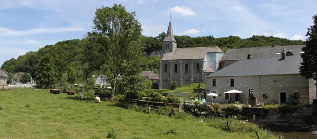
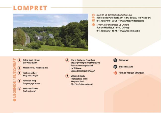
Location: Chimay, Province of Hainaut, Fagne-Famenne region, Belgium.
More info: www.beauxvillages.be
Download the walk
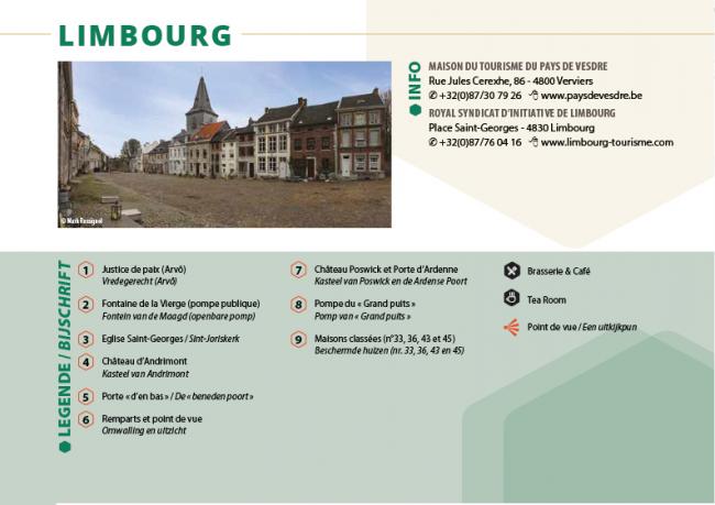
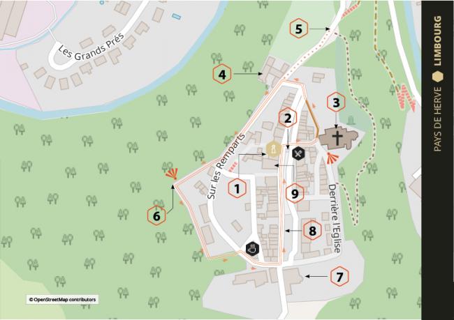
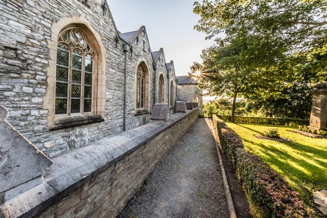
Although it's a French-speaking town today, Limbourg was the capital of a duchy that gave its name (Limburg) to two provinces in Belgian Flanders and the Netherlands. Well, well! It was seized by King Louis XIV of France in person, as depicted in paintings, murals and even a low-relief sculpture on the St Martin gate in Paris. Today, the town's ramparts peacefully overlook the River Vesdre. Explore a stornghold steeped in noble stories and listed as an Exceptional Walloon Heritage Site.
Stop for a drink or a meal at the brasserie or the tearoom after having a look at the former Justice of the Peace's house, St George's church, the pebble-cobbled Place de Vesdre, the Lower Gate and Ardenne Gate and the ramparts with their lovely views over the landscape of the surrounding Pays de Herve, the Hertogenwald and the Ardennes hills.
Location: Limbourg, Province of Liège, Herve region, Belgium.
More info: www.beauxvillages.be
Download the walk
What grabs your attention in Soiron are the elegant Meuse Renaissance-style buildings, dating from the seventeenth and eighteenth centuries. Their bluestone window surrounds, architraves and alternating courses of brick and stone can be found all over the village. Set off from the Place du Bac to explore the majestic St Roch's church and the shrine dedicated to the same saint; the Louis XV-style chateau dating back to 1723; the former blanket factory; the priest's house and the nondescript former brewery.
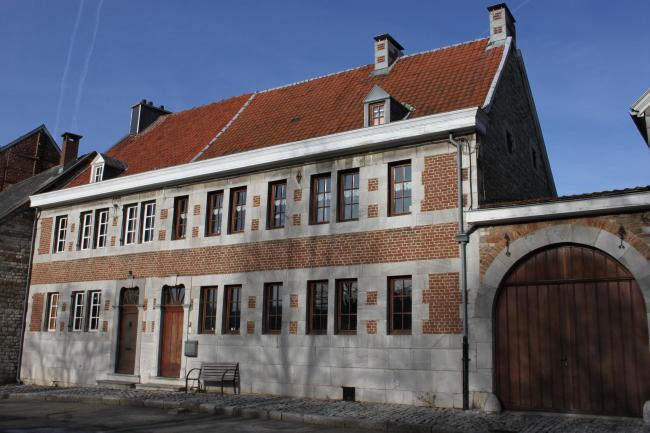
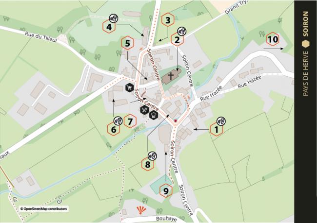
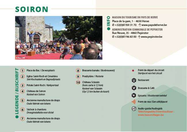
Stop for refreshments at the restaurant, the grocer's shop or the café. Don't miss the thistle-drying shed with its 160 holes, or the nearby Sclassin Castle, dating back to 1587.
Location: Pépinster, Province of Liège, Pays de Herve region, Belgium.
More info: www.beauxvillages.be
Download the walk
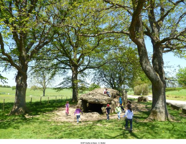
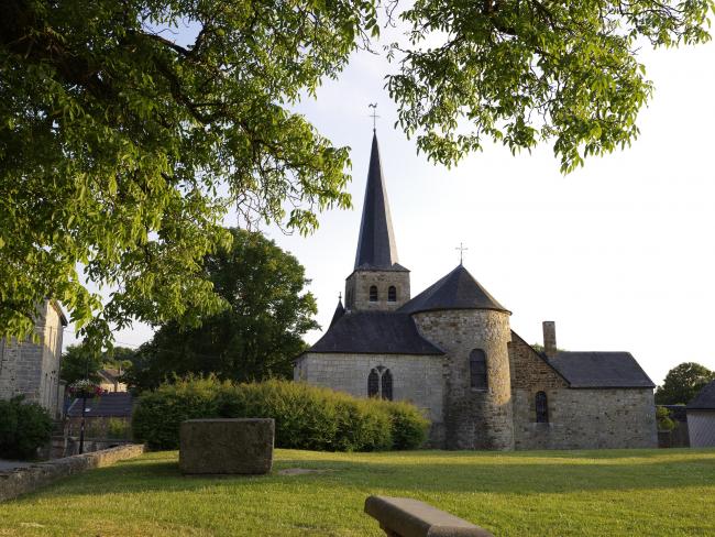
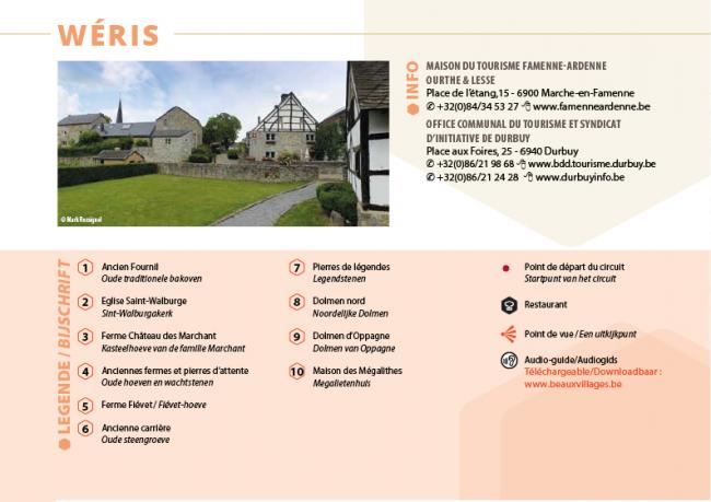
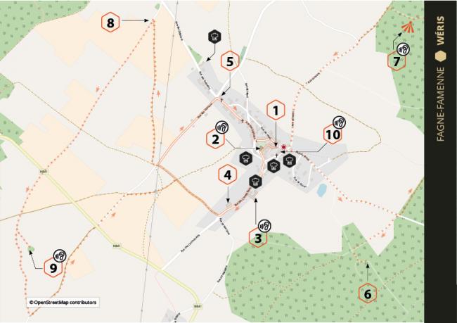
If the devil really sleeps at Wéris as the legend claims, then he must have played with the fairies because this village has received so much from stone. On the one hand, flamboyant countryside, a beautiful eleventh-century Romanesque church, charming half-timbered sandstone or limestone buildings, a grocer's shop and two restaurants, one of which has a Michelin star. On the other hand, the most prestigious megalith site in Wallonia with its pudding-stone dolmens and menhirs, dating back to around 3000 BCE, but also stones linked to legends such as the Haina stone, the Devil's Bed and the Pas-Bayard.
Whether they be gourmets or not, explorers should not miss a visit to the interesting Megaliths Museum, dedicated to the neolithic period.
Location: Durbuy, Province of Belgian Luxembourg, Fagne-Famenne region, Belgium.
More info: www.beauxvillages.be
Download the walk
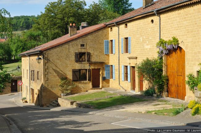
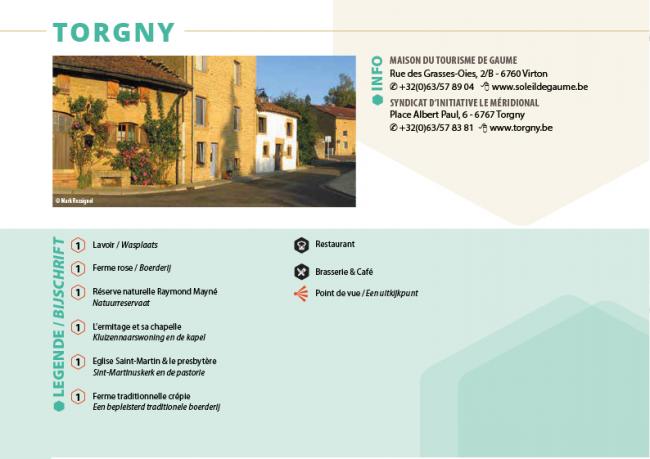
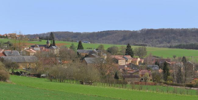
In Torgny, you have the impression that Provence has moved North. You can enjoy its sunny micro-climate, gentle countryside and "long" farmhouses, with their yellowish limestone walls and red-tiled roofs, even more if you stay overnight here. The small village square is home to a public wash house and restaurants with sunny terraces. There's also a nature reserve where you can see garden thyme, wild thyme, flax, wild garlic (which makes wonderful pesto!) and orchids, as well as praying mantises, grasshoppers, crickets, grass snakes, lizards and a wide variety of butterflies.
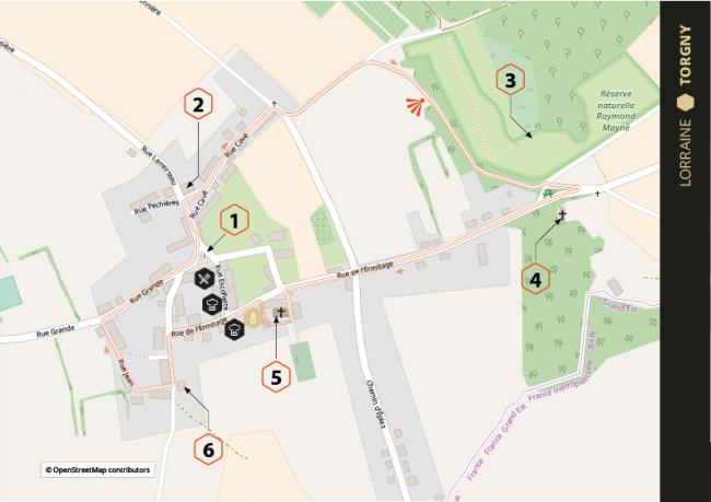
A good plan would be to cross the nearby frontier and to lose yourself in a place where it feels like time's stood still, near the villages of Flassigny and Juvigny, the Renaissance town of Marville, the "cathedral of the fields" at Avioth, the castle at Louppy-sur-Loison and the spectacular citadel at Montmédy.
Location: Rouvroy, Province of Belgian Luxembourg, Lorraine gaumaise region, Belgium.
More info: www.beauxvillages.be
Download the map
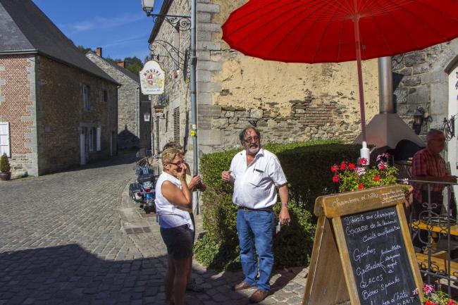
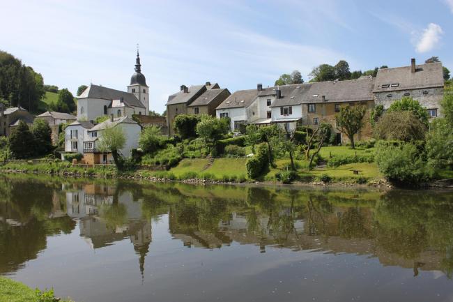
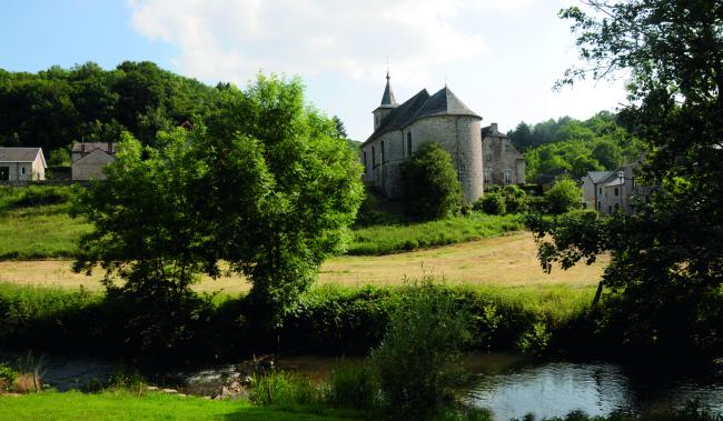
Together with Bouvignes on the Belgian side of the frontier, Hierges is a Meuse-valley village that transports you back to mediaeval times on the Meuse between Maastricht and Verdun. Take a stroll along the cobbled Rue Roger Renard lined with bluestone houses with slate roofs. Don't miss the short climb up to the church of St. John-the-Baptist. Follow the path that runs along the foot of the town walls to get to the thirteenth-century watermill and then explore the village square, with its refreshing fountain set at the foot of the romantic castle ruins (guided tours available by prior reservation).
Constructed in the ninth century on a rocky outcrop, the castle was rebuilt in the sixteenth century in the pure Meuse Renaissance style mandated by the Principality of Liège in its French, Belgian and Dutch territories. It was unfortunately destroyed during the French Révolution, but its majestic ruins remain impressive. It is said to have been identical to Beauraing castle.
To discover the village's best-kept secret, stop for lunch at La Causerie des Lilas in the village square: this inn is unmissable. In an old-fashioned atmosphere, the owner will offer you, among others, meat grilled over a wood fire; runny, ripe Camembert cheese, roast potatoes and Ardennes salamis. When I ate there, I was served ceps on toast (real ones, not generic mushrooms!) and snails from the neighbouring village of Auberives, another pretty Ardennes village on the River Meuse that is worth a special trip.
Location: Hierges, département of the Ardennes, France.
More info: www.ardennes.com
It's like the Aveyron in the Middle Ages here. Nestled around the ruins of its castle on the cliff, encircled by the river and set amid hills, Esch-sur-Sûre is a pearl among those destinations that make you immediately want to set off to visit them, even if they are nearby. As soon as you're on the road there, and through two tunnels, you come to a lake around which are countless opportunities for walks and the feeling of getting away from it all is guaranteed.
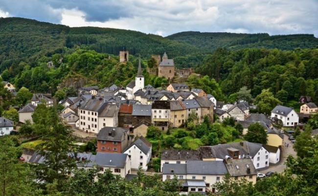
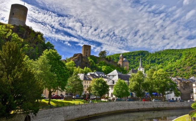

Leave your suitcases in one of the town's hotel-restaurants and wander through its narrow streets. Climb up to the castle, built in the tenth century after a certain Méginaud obtained it in a property exchange with Stavelot Abbey in Belgium (open for visits). Then visit the pretty "Duch vum Sei" weaving museum, where there's a daily two-hour guided tour as a bonus.
Location : Esch-sur-Sure, Éislek (Luxembourgeois Ardennes), Luxembourg.
More info : www.visit-eislek.lu
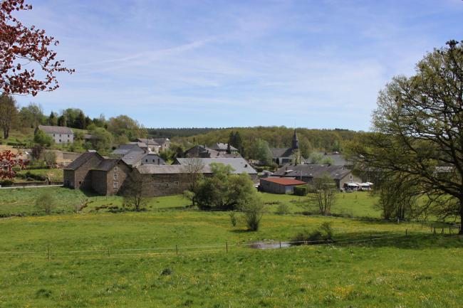
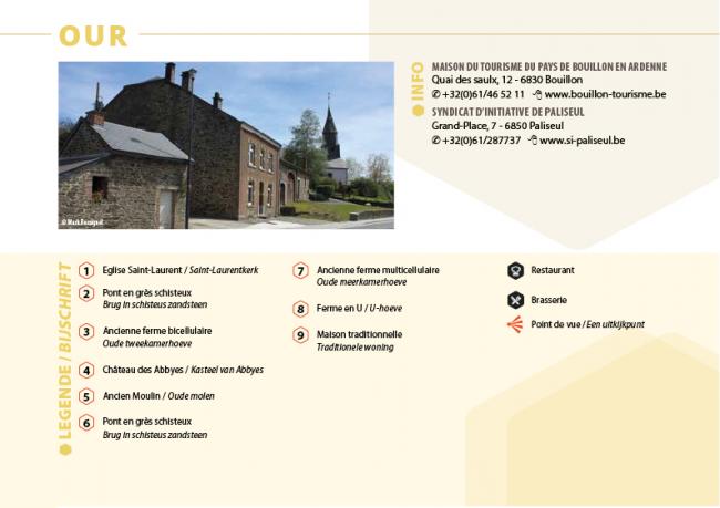
For a description of the village of Our, nobody has put it better than our good friend Jean-Luc Duvivier de Fortemps (in his book "The Lesse in the Ardennes" published by Presse Duculot). "The village of Our nestles in the hollow of the Our valley that has been gently eroded over time. The bottom of the valley is occupied by typical Ardennes-style buildings, while the steeper sides of the valley are covered in forest. The Our has carved out a short channel between the village and the watermill, where a chaotic pile or rocks hinders the river's flow. Its clear water flows quickly between the flat stones, whirls in the darker depths and forms countless mini-waterfalls".
We suggest enjoying a treat from a holders of our Ardennes brand. Book a table or a room at the establishment run by the gentleman known as Maxime Collard.
Location: Paliseul, Province of Belgian Luxembourg, Ardennes region, Belgium.
More info: www.beauxvillages.be
Download the walk
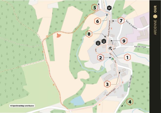
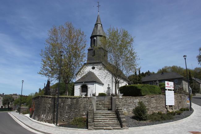
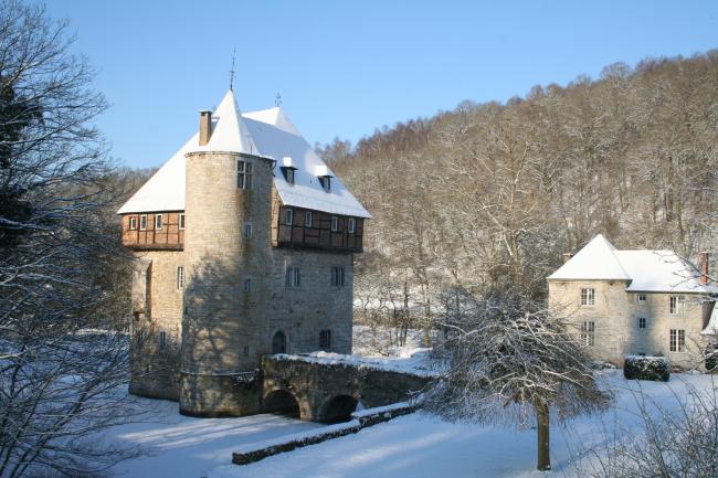
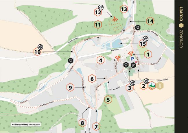
A walk around Crupet is ideal if you're looking for complete authenticity and delight: it's a real showstopper. Its setting is so typical of the Condroz at the bottom of the valley of the River Crupet and its tributaries, cut into sandstone and limestone rock, which gives its buildings their colours. As for the village, what can I say? First the keep of Carondelet castle, built in the thirteenth century with its moat. Then St Martin's church with its fabled series of artificial grottoes telling the story of the life of St Antony of Padua, created by a former parish priest. And then, from Low Street to High Street, houses, small gardens, courtyards, an old school, a chapel and water flowing down the steep hill from the confluences of the Ry, the Jance, the Mière and the Vesse, a former paper factory and watermills formerly used in the production of oil, flour and hemp.
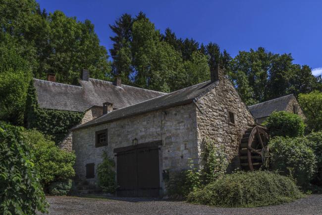
Pop into the tourist information centre for some good advice. But, above all, allow time to sit down in one of the three inns to quench your thirst with a some local beer, then ask someone to tell you the legend of the devil's boot in this land of saints.
Location: Assesse, Province of Namur, Condroz region, Belgium.
More info: www.beauxvillages.be
Download the walk
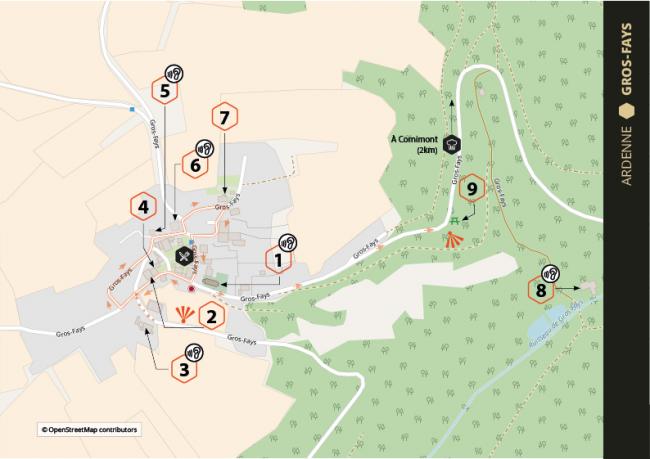
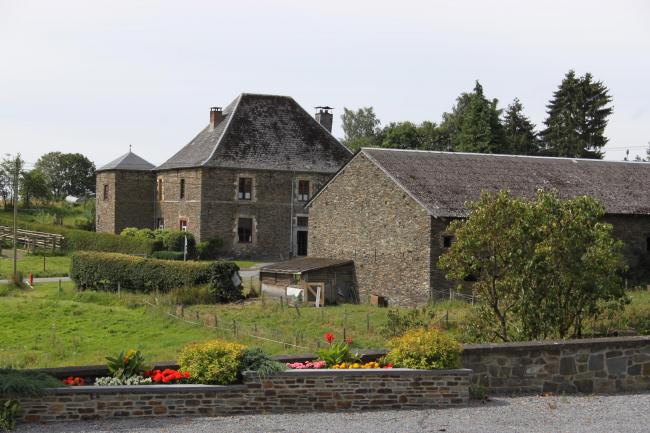
Located in a clearing in the middle of a vast forest, Gros-Fays is in itself a reflection of the Ardenne and its geological massif. Almost all its buildings (farmhouses, school, castle, watermill, brasserie) are built of schist stone, sometimes whitewashed, quarried from one of the local quarries that remain visible in the landscape. Its a bit like Brittany, with the sea replaced by the forest, stretching out into the distance as you look up from a street or a field. Everything encourages you to travel, not by boat but rather on foot or by bike along one of the many hiking trails.
In addition to enjoying the views of the Semois valley from the observation points, you must stop at the precious village café, where you'll get a warm welcome, and maybe a song from the owner.
The most inquisitive visitors will linger to look at the former tobacco factory and won't miss the exceptional Tobacco Museum at Corbion (17km away). For the more adventurous, the Semois valley can also be explored by kayaking down the river, starting at the Récréalle leisure centre, anther holder of the Ardenne brand, among other places.
Location: Bièvre, Province of Namur, Ardennes region, Belgium.
More info: www.beauxvillages.be
Download the walk
While the valley of the Meuse is monumentally huge, the valley of its tributary the Molignée offers more gentle countryside in which the village of Falaën happily sits. The walk around the village is delightful and includes several viewpoints. Starting at the village square, wander through the narrow streets to look at around thirty traditional-style eighteenth and nineteenth-century houses, huddled around St Leger's church, and the fortified manor house with its four unusual corner turrets.
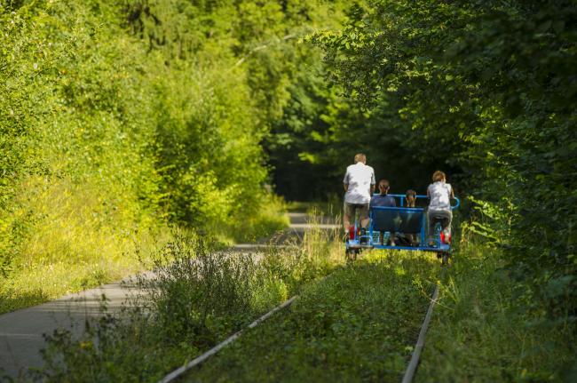
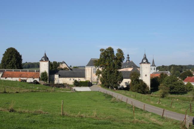

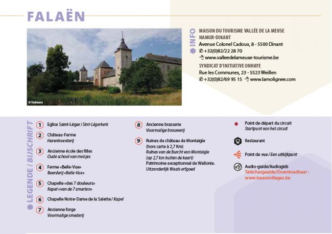
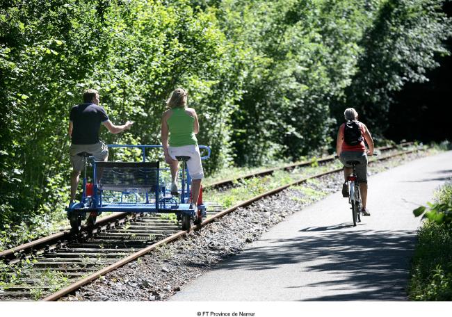
An idea for a day blending sport with culture and gastronomy is to do the village walk in the morning, then take a trip on the Molignée pedal-car railway (departs from the former railway station at pre-booked times). These pedal-cars are odd four-wheeled bikes seating several people that you pedal along a disused railway track. The route runs through Sosoye to Maredsous Abbey (please note that the railway timetable only allows you an hour there to taste the abbey's famous beer and cheese, in moderation, given the effort required to pedal back). Once you're back in Falaën, you can round off your day with a meal on the terrace or by the fireside at the delightful La Fermette restaurant.
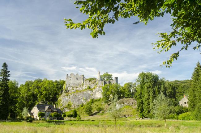
For a bonus, stop 2.7km east of Falaën on the N971 to explore the mysterious, romantic ruins of Montaigle Castle, which will take you back to the mediaeval legends of the Meuse valley. The ruins resemble those of the Cathar fortresses but without the giddying heights.
Location: Onhaye, Province of Namur, Condroz region, Belgium.
More info: www.beauxvillages.be
Download the walk
As Guy Denis wrote, "in the Ardennes, you know, legends are written into reality. It's our nature that wants that! The forest is the legend of the Ardennes." It's therefore not surprising that the Ardennes village of Laforêt "surrounded by the tenacious people of the trees" (Jules Michelet 1798-1894), so many legends are found. Even more than the many legends associated with the River Semois, which welcomes the village to its left bank, and which is seen almost everywhere as a refuge for fairies and witches.
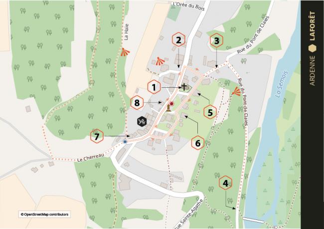
So, before or after the village walk, where you'll discover a delightful group of schist-stone buildings which remind you of old-fashioned farming, especially tobacco-farming, don't miss the 2km Legends walk (which is suitable for push-chairs), where you'll meet the wild hunter, Grandpa Crochet, the White Lady, Verbouc, the devil, goblins and the Mawhotte.
Ah yes, in the village you'll see that in the Semois region, more than elsewhere, the devil hides in the details... Amuse yourselves by looking for the good-luck hearts on the barn doors and bulls-eye openings in the walls.
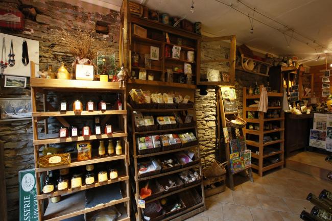
My two special favourites are the grocer's shop-cum-brasserie and the sublime Claies bridge, the last of its kind, made of hazel branches placed on timber pillars. It is built each year in June by a group of generous locals, who then dismantle it each September. From the bridge, it's a pleasent 3km walk to Vresse.
Location: Vresse-sur-Semois, Province of Namur, Ardennes region, Belgium.
More info: www.beauxvillages.be
Download the walk
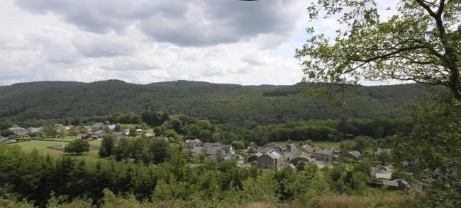
Tournavaux and Haulmé have the odd particuliarity of being located on a wide plain but also in the middle of a valley that is steep-sided in places. If you rotate full circle, all you can see in the distance are hills and ridges all covered in deciduous trees. The plain walk is 4km long and will take you about an hour-and-a-half. If you can, get up to "La Roche aux Corpias" ("The Crows' Rock" in the local dialect) or travel a bit further to the Liry viewpoint, where you can enjoy superb views over the Semois-Semoy valley, the immense Ardennes forest and the two villages. It's certainly worth a special trip!
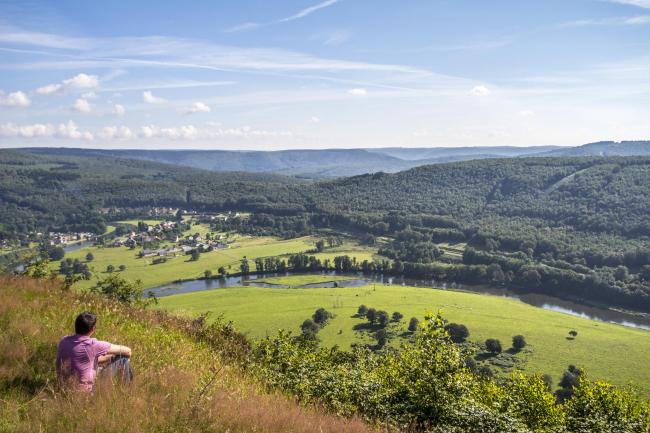
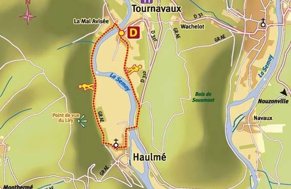
For those Belgians who've decided, rightly, to cross the frontier into France, where the Semois becomes the Semoy, and to follow the river to its confluence with the Meuse at Monthermé, there is an opportunity to enjoy no less than two typical French restaurants with guest rooms!
Location: Tournavaux, Département of the Ardennes, France
More info: www.ardennes.com
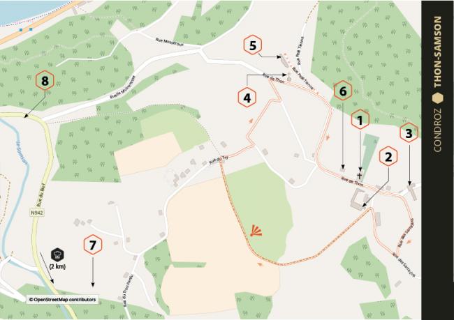
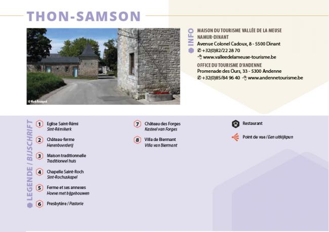
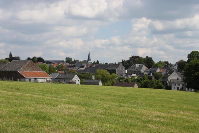
Perched on the hilly sides of the Meuse valley, the villages of Thon and Samson also owe a lot to the river that flows through them. Even though it's sometimes mixed with brick, grey limestone predominates in the buildings of the Condroz, a district that some geographers class as part of the Ardennes. This walk isn't long but it's quite demanding, for Thon is located 100m higher up than Samson. St Rémi's church dates back to 1780 and the fortified manor house to the seventeenth century. Forges castle, the priest's house and some traditional farmhouses and houses complete a natural landscape of meadows, copses, hedges, rocks and water.
Don't forget to visit, a stone's throw from the village, the ruins of the castle built by the Counts of Namur to allow them to control the Meuse between Marche-les-Dames and Sclayn. Standing over 80m tall on a towering cliff, there are magnifient panoramic views from it.
Location: Andenne, Province of Namur, Condroz region, Belgium.
More info: www.beauxvillages.be
Download the walk
Olne has its feet in the Herve scrubland, but an eye on the nearby valleys of the Ardennes. The landscape speaks of itself. The buildings, as in Soiron, recall the wealth of the Meuse Renaissance in the seventeenth and eighteenth centuries, and the distant era when Olne rivalled the other Walloon manufacturing centres of textiles, nails, pottery and stone-quarrying. Today, Olne is much more agricultural than industrial.
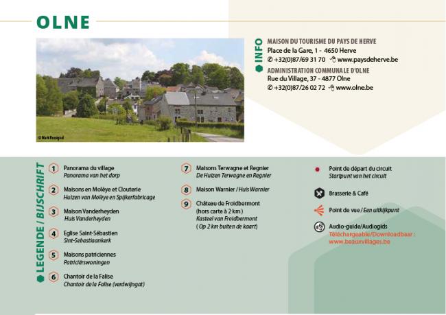
The walk begins at the café-brasserie which enjoys panoramic views of the village. From there, move to St Sebastian's church and its surrounding farmhouses, workshops and townhouses, built by the Protestants who brought economic prosperity to the village. Another mysterious curiosity is Le Chantoir de la Falize, where one of the local streams, the Ri d'Aronde, bubbles up from underground.
Location: Olne, Province of Liège, Pays de Herve region, Belgium.
More info: www.beauxvillages.be
Download the walk
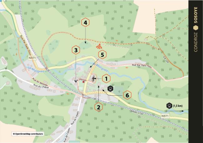
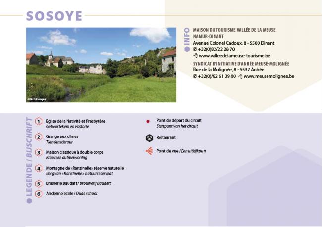
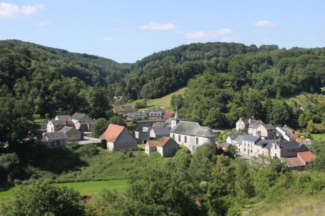


Sosoye is a distillation of all the charms of the Molignée valley. It is built of limestone and crowded around its church on one side, and a landscape of valleys clothed in deciduous forest on the other. And through the middle flows the completely untamed river. Sosoye also brings together some beautiful curiosities for fans of effort and comfort.
Sporty visitors can take up the double challenge from the inhabitants, known locally as "the mountain people", by climbing to the top of the Ranzinelle "mountain" and having a go on the Molignée pedal-car railway (which runs from Falaën to Maredsous). Epicurean visitors can stop in either of the two restaurants in the village and shouldn't miss the opportunity to taste the beers and cheeses made at Maredsous Abbey in what is undoubtedly the biggest beer garden in the Ardennes.
Other must-see attractions in the pretty Condroz region are the soaring ruins of Montaigle Castle a few kilometres from Sosoye (see Falaën village walk above) and a trip in a railcar on the single-track Bocq Valley Railway, whose many viaducts and tunnels make it one of the most spectacular in Belgium!
Location: Anhée, Province of Namur, Condroz region, Belgium.
More info: www.beauxvillages.be
Download the walk